Eric Ross likes maps and draws many of them. Ross grew up in Montreal and is a Canadian citizen but was born in Turkey. He has a Masters Degree in Geography and a Doctorate in Islamic Studies and is currently an Associate Professor of geography and research methods at Al Akhawayn University in Morocco. His specialty is the cultural and urban geography of Muslim Africa.
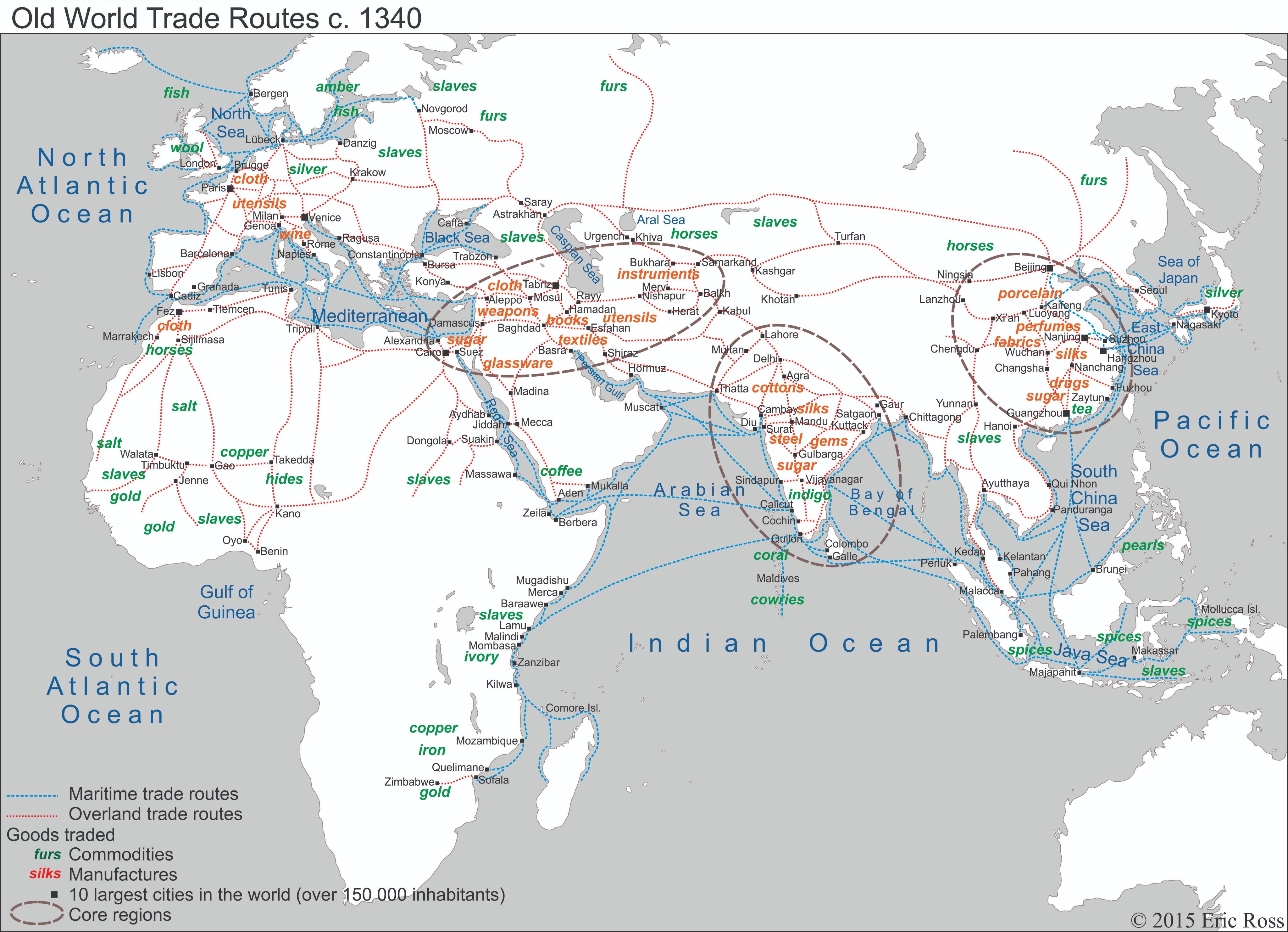
The map below shows the major trade routes in the Old World about a century and a half before the voyage of Columbus and just before the outbreak of the Black Death later in the 1340s. The major nodes of trade are in the Middle East, India, China, and the Middle East. At the time, all of China and most of the Middle East were dominated by the Mongols.
Four of the ten largest cities are in China - Beijing, Nanjing, Hangzhou, and Guangzhou. Two of the other big cities, Fez in Morocco and Tabriz in what is now Iran, are much smaller today. Tabriz was the capital of the Mongol's Middle Eastern dynasty, while Fez hosted its own prosperous Moslem dynasty. It was at this time that Ibn Battuta, the famed Moslem traveler, set out from Morocco on his great journey. From 1325 to 1354, Battuta visited Moslem Spain, North Africa, the Middle East, India, and possibly China, making a final visit across the Sahara Desert to West Africa, a journey on which he provides a detailed description of the slave trade from that area to the Moslem world. On the map below, slaves show up as a major commodity in several areas besides West Africa, including the Slavic areas of Eastern Europe, the Caucasus, Sudan, East Africa, Southeast Asia, and the islands of what is now Indonesia.
At this point, Europe had many trade routes but is not designated as a core trade area by Ross. This was to change over the next century as European rapidly became more wealthy.

No comments:
Post a Comment