There's a social media meme going round in which guys are asked about how often they think about Rome. As can be seen from THC's history it turns out to be quite often.
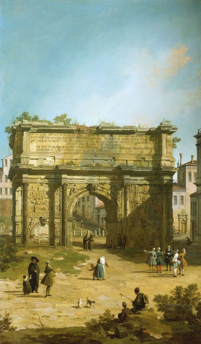
Most recently I came across a painting of the Arch of Septimius Severus in 1742 by Canaletto and a photo of the arch from 1895 (via Imperator Cat on twitter). The two provide a graphic illustration of the disrepair the Forum had fallen into after the 6th century when the drains were no longer maintained and the area subject to frequent flooding.
Severus was emperor from 193 to 211 and the Arch celebrates his victories over the Parthians in Mesopotamia and annexation of new lands.

And, to tell the truth about how often I think of Rome, it is pretty frequently because this 33"x46" map hangs in the room where I am writing this is a constant reminder.

The map also shows the Severan advance into the deserts of Libya (the emperor was a native of Leptis Magna in that province) and reflects the most recent discoveries and research on Roman boundaries. Until recently it had been thought the the Roman border in Arabia went north from the Red Sea and through the center of today's Jordan. However we now know the Roman lands included much of what is now northwestern Saudi Arabia which is reflected in the map. The map also depicts the 21st century discovery of a Roman garrison on the Farasan Islands near the southern end of the Red Sea (discussed in The Farthest Outpost).
This wonderful map was prepared by Dr Michael Ditter in Germany. Dr Ditter has created a series of maps of the ancient world which you can find at his website.
As to what I think about Rome, I recommend you read Ciceroing.
No comments:
Post a Comment