This view of the Mediterranean and surrounding lands on a north-side axis instead of the usual east-west is disorienting but brings you into the perspective of those living in Classical times.
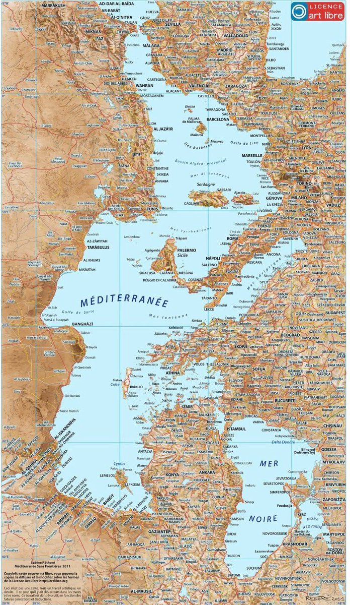
I've always liked these different perspectives and wrote about a view from the Horn of Africa a few months ago. Without a scale, my first impression is that the Mediterranean looks more like one of the Great Lakes than a Sea, and it accentuates the connection between it and the Black Sea.
More than 90% of the lands shown were part of the Roman Empire during its heyday of the first three centuries AD - the only time when the Mediterranean was completely under the control of one power. The centrality of Italy, Sicily and what is now Tunisia in North Africa is also emphasized as is the connection between Asia Minor (which looks like Michigan to me) and Greece, with the scattered islands between looking like shattered shards of marble. You can easily see how the Anatolian farmers spread from Asia Minor into the Balkans and the rest of Europe from 7000 to 3000 BC. From 3000 BC on, Europe was overrun by the Yamnaya of the Eurasian steppes, whose genetic imprint now dominates throughout the continent, except for isolated Sardinia, which retains its Anatolian imprint.
Something else is accomplished by this view. In the traditional orientation, while Rome dominates a lot of Europe, most is still left to the "barbarians". But in the Roman view, what we see here was, by far, more important - it is where civilization, wealth, and population resided, not the poor and underpopulated north and east of Europe.


![Map of Geographical Definitions circa 1870 [1400x1118]CLICK HERE FOR MORE MAPS!thelandofmaps.tumblr.com](https://lh3.googleusercontent.com/blogger_img_proxy/AEn0k_v6hNLlgE2gR4_3wQzIZrzVGeEafBm2eXUVdS0bJqXQGrY51xsjr2nTCbUorf6IELUlbZZPp1laSz5KdfLTgqCtLwiuvLJJdQuGR62NXn70e10p_0R0wSEiFgtfMzL85xkR1kWRZWoTj33vFQoHGf63yBtyCq5JYpU5dUrvhXVdMM29=s0-d)
